KEYNOTE
9 July 2025, 6:20pm
Bibliothèque nationale de France (BnF), site Richelieu (entrance: 5 rue Vivienne)
The Japanese Buddhist World Map and its Parisian Reception: A Case Study in the Transcultural Circulation of Cartography
D. Max Moerman
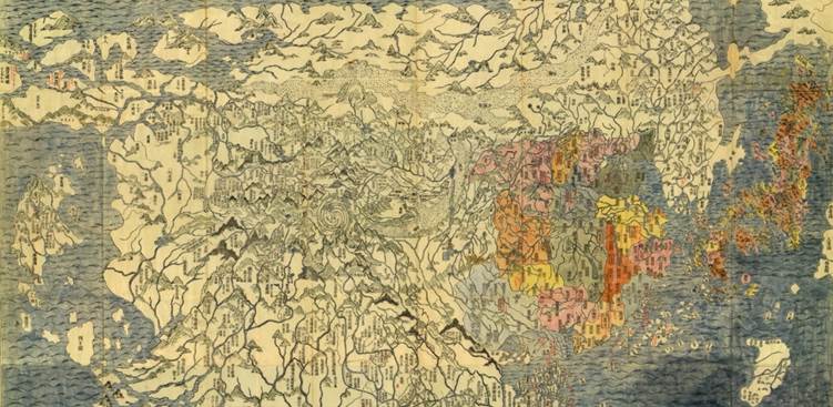
In Kyoto, in the year 1710, the largest and most detailed Buddhist map of the world was published as a wood-block print. More than one century later, three different versions of this Japanese Buddhist world map were translated, redrawn, published in Paris as lithographs accompanying the earliest European studies of the travels of medieval Chinese Buddhist pilgrims to India. This talk examines the significance of Japanese Buddhist cartography for the origins of the academic study of Buddhism in Europe. In doing so, it seeks to shed light on the unrecognized contributions of Japanese Buddhist cartography to the development of Buddhist Studies in the West.
D. Max Moerman is Professor in the Department of Asian and Middle Eastern Cultures at Barnard College, Columbia University. He is the author of Localizing Paradise: Kumano Pilgrimage and the Religious Culture of Premodern Japan (2005) and The Japanese Buddhist World Map: Religious Vision and the Cartographic Imagination (2022).
SPOTLIGHT
11 July 2025, 4:15 pm
Campus Condorcet Conference Center (Centre de Colloques)
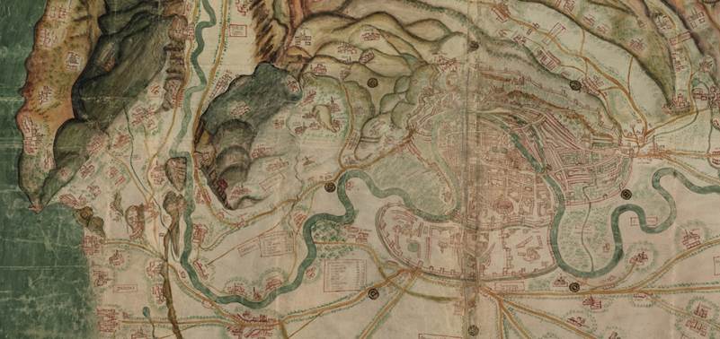
At the Crossroads between Knowledge and Practice: New Lights on Medieval Mapping
Juliette Dumasy-Rabineau
Contrary to the belief that few if any large-scale maps were produced in Europe before the modern period, recent scholarship has highlighted that, in fact, hundreds of them survive, scattered in multiple archival deposits. Indeed, in the last centuries of the Middle Ages, political and seigniorial authorities made an increasing use of cartography in their day-to-day business. Combined with pragmatic literacy, these local and regional maps offered a vivid knowledge on places and territories in order to help decision-making. They were usually commissioned from painters, who, on the basis of their visits in the field and their artistic skills, developed specific techniques for mapping. For all these reasons, such maps stand at an intriguing crossroads between practices and knowledge of space, power, literacy and art – a combination that played an important but still little-known part in the genesis of maps of the modern era.
Juliette Dumasy-Rabineau is Associate Professor of Medieval History at the University of Orléans, France. She was co-curator of the exhibition Quand les artistes dessinaient les cartes. Vues et figures de l’espace français, Moyen Âge et Renaissance, at the Archives Nationales in Paris in 2019. She published, with Camille Serchuk and Emmanuelle Vagnon, Towards a History of Local Maps in Medieval and Early Modern Europe, Paris, Le Passage, 2022.
