
The exhibition “Quand les artistes dessinaient les cartes : vues et figures de l’espace français, Moyen Âge et Renaissance” (When artists drew maps. Views and figures of France from the Middle Ages and the Renaissance) will be held at the Archives nationales (Paris) from 25 September 2019 to 7 January 2020. Bringing together over 100 … Continue reading Exhibit/Conference: Quand les artistes dessinaient les cartes (Archives Nationales, Paris, France), starting September 25, 2019
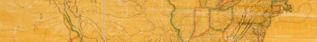
Mapping a Nation: Shaping the Early American Republic (Exhibition/Conference) (Philadelphia, PA, USA)
Mapping a Nation: Shaping the Early American Republic (open through December 2019) traces the creation and use of maps from the mid-18th century through 1816 to investigate the way maps, as both artworks and practical tools, had political and social meaning. It features historical maps, surveying instruments, books, manuscripts, and other objects to show how … Continue reading Mapping a Nation: Shaping the Early American Republic (Exhibition/Conference) (Philadelphia, PA, USA)
Symposium – Mapping the Global Imaginary (Stanford, Feb. 2019)
On February 14th – 15th, 2019 The David Rumsey Map Center (Stanford University, Stanford, California, USA) will host a two-day conference on ‘Mapping and the Global Imaginary, 1500 – 1900’. The conference is co-sponsored by the Stanford History Department, Global History & Culture Centre at the University of Warwick, England, UK, and the David Rumsey … Continue reading Symposium – Mapping the Global Imaginary (Stanford, Feb. 2019)
